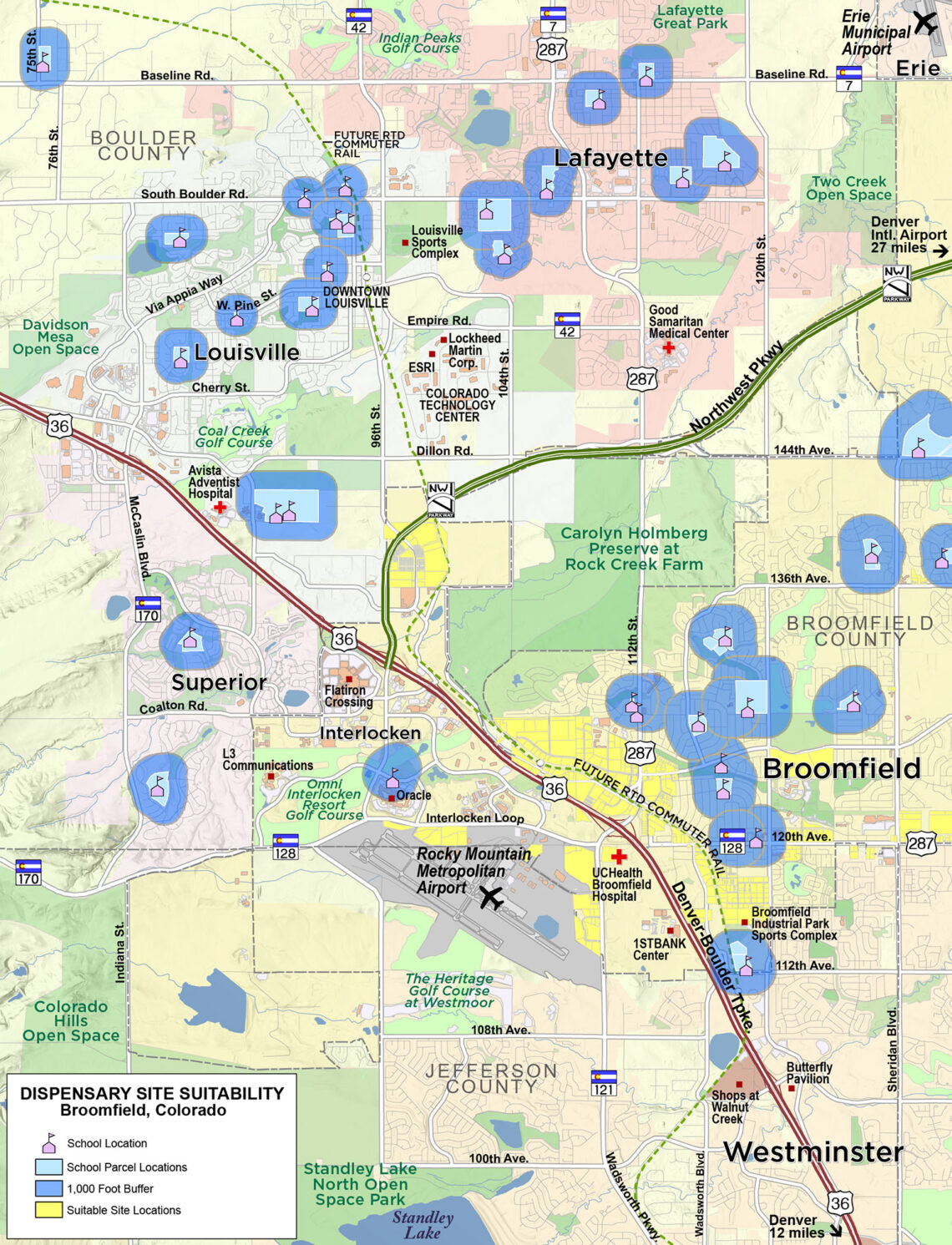
Map Notes:
Dispensary site selection map of Broomfield, Colorado, showing public and private school locations and their mandatory 1,000-foot buffer zones (“sensitive areas”) around each, depicting locations that are off-limits for cannabis sales.
Following state and local parameters for dispensaries, such as specified distances from public/private schools, day care centers and youth centers as well as abiding by zoning regulations, we can help you locate a suitable site for your operation.
Note: unfortunately you're not getting hi-res maps on your mobile device. We highly recommend you view our hi-res maps on a tablet or full-size display using a wifi connection to truly be able to see the quality and detail of our work!